
We have had the pleasure of staying in Kauai for several weeks during the end of summer when the weather is perfect for exploring. The days are warm with a mixture of sunny and rainy days which makes for a nice variety. The nights are cool enough to be comfortable while sleeping without even considering the need for an air conditioner.
Combine great weather with the beauty of this island and the almost non-existent COVID cases here and we have to admit that we fell into a very fortunate situation!
Those who know us will not be surprised to learn that we have managed to stay busy and we have explored a bit of the island. Although we have only anchored in Hanalei Bay, we have taken TTR down the Nā Pali Coast a couple of times to view her beauty from the water. We have also taken several hikes in different areas of the island. And we took a helicopter tour of Kauai! So indeed, we have explored by land, by sea and by air!
Initially I was going to cover all of our hikes, sails and helicopter tour in one post, but there are so many great pictures that I am spreading the information over several posts.
Let me begin by sharing just two photos from our sailing trip down the Nā Pali Coast since I have already written about that.
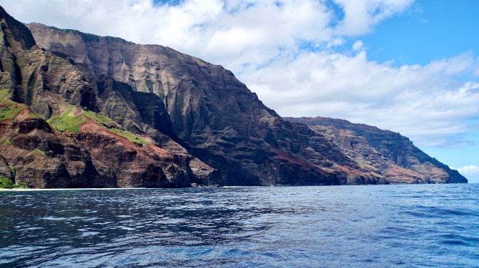
Looking west along the Nā Pali Coast.
From a sailor’s perspective, Kauai looks magical and difficult. I could imagine how fertile the land is in places and how available fresh water is from all of the waterfalls. Yet the sheer wall faces and uneven terrain look like it would be difficult to walk or settle the area.

A small waterfall near the ocean.
However, one of the most beautiful hikes we have ever taken, the Kalalau Trail, traverses this Nā Pali coastline for 11 miles. The complete hike covers five valleys, takes a full day and requires a park pass. However, the first two miles of the trail end at the Hanakāpī’ai Stream and park signs estimate walking to the stream takes 1.5 to 2 hours.

The beginning of the Kalalau Trail.
We were definitely up for the hike to the stream and set off at a snails pace since the scenery and fauna were captivating… and I had to try to get some decent pictures.

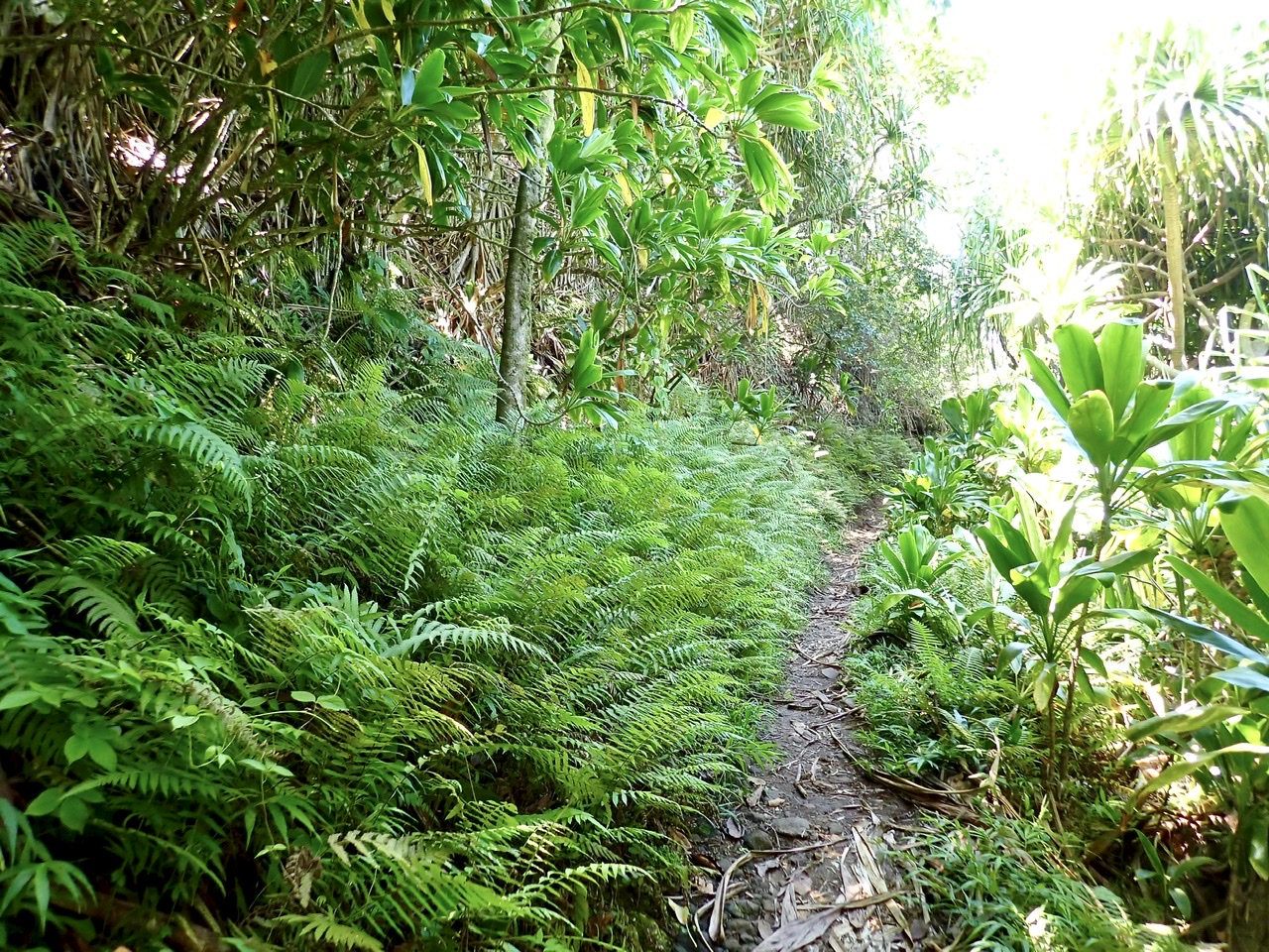
Most of the trail was shaded and easy to walk.
The trail was originally built in the 1800s to connect Hawaiians living in remote regions of Kauai and the beginning portions of the trail were restructured in the 1930s to accommodate horses and cattle.

Looking east back toward Kē’ē Beach where we started the hike.
Once the restructured portion of the trail ends, the remainder of the hike is a narrow, natural trail that weaves up, down and around. It can be very muddy and slippery, but fortunately we caught a dry day and the “conditions were perfect.”
Clearly these ferns thrive in the damp environment.
The views changed constantly as the plant species include indigenous and imported varieties. Combine the varied plants with a trail that weaves toward and away from the cliffs along the ocean and we were rewarded with visions that changed from land to ocean.

Looking west along the Nā Pali shoreline.
My Eagle Scout is always well prepared so we had plenty of water but we forgot to bring any food. However, Mother Nature provided an abundance of ripe guava along the trail and we ate a few of these to satisfy our hunger.

Frank breaks open a guava…doesn’t get much fresher!

These roots reminded me of hula skirts.

A perfect day for hiking and photographs.
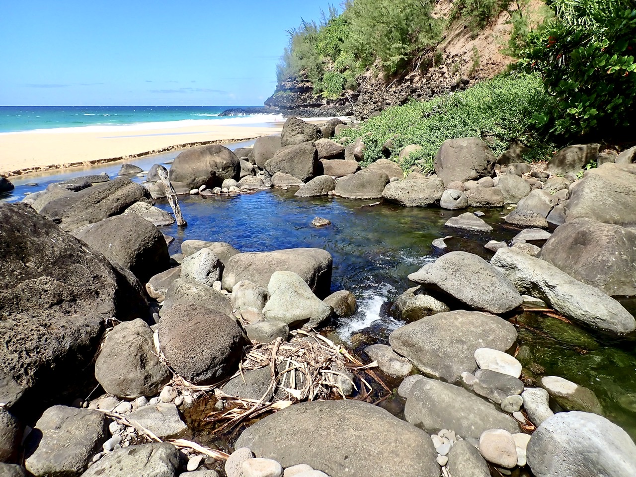
Even though the trail was mostly shaded, after walking a couple of hours, we were a bit hot. Luckily for us, the end of this portion of the trail stops at the fresh water Hanakāpī’ai Stream. The stream tumbles around time worn boulders and ends right on the white sand beach where it meanders into the Pacific Ocean.

The fresh water stream winds downward to the beach.
Of course we took a dip in the pools formed at the end of the stream and watched the ocean waves crash against the cliffs and sand while we sat in the quiet water of the river.

Sitting in the rock edged pool at the mouth of the Hanakāpī’ai Stream.
If we had any doubt that the water was fresh water, the numerous tadpoles put our minds at rest.
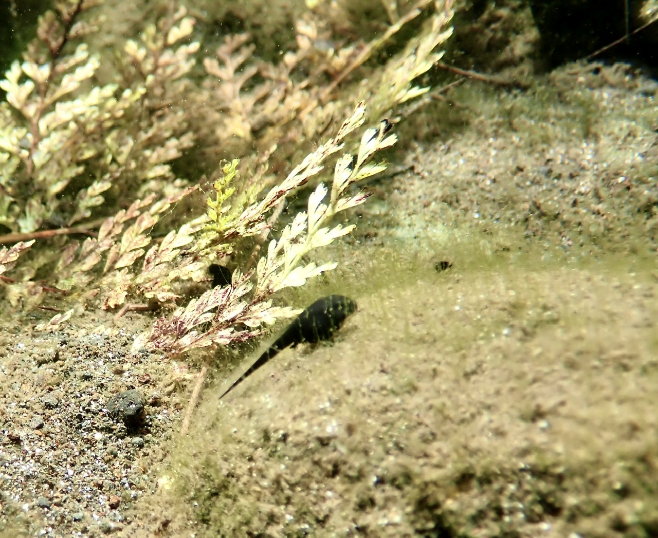
No signs of transformation on this tadpole.
The last river pool and the path the escaping fresh water takes to the right.
The stream made a very definite path through the sand beach, flowing to the right, heading slightly downhill, then turning left until the tide crossed the sand and the two bodies of water met in the middle of the beach.

You can see the stream flow to the right and in the distance cross left to join the ocean.
We must have spent about an hour exploring the beach and wading in the stream. There were even a couple of caves along the beach that we looked into. It was a very refreshing change to be in fresh water and not feel sticky from salt as our skin and clothing dried on the walk back.
In non-COVID times, this walk is extremely crowded and is one of the most popular hikes in Hawaii. How popular is the hike? Well the Hā’ena State Park limits their day use permits to 900 per day!!! Furthermore, the site says the passes sell out quickly.

A helicopter view of Hanakāpī’ai Beach with an arrow pointing to the river on the beach.
I counted the number of people we encountered during our day. All told we saw fewer than 30 people on the hike, in the stream, on the beach and in the ocean.
Needless to say, we experienced the Kalalau Trail in a way few modern travelers have or will.

2 thoughts on “Kauai By Sea, By Land And By Air ~ Part 1”