
The drive from Hanalei Bay to Waimea State Park was about 2.5 hours but we had heard so much about the Waimea Canyon that we really wanted to make the trip.
Fortunately our friends, Katie and Kevin, invited us to have dinner and stay the night with them at their beautiful home on the west side of Kauai. Not only did we get to spend time with these fun people and enjoy Katie’s fabulous cooking, we were able to hike the Waimea Canyon two days in a row!
As you know from Kauai By Sea, By Land and By Air ~ Part I, our hike along the Kalalau Trail was stunningly beautiful. Our next adventure was on the western side of Kauai in the Waimea State Park.
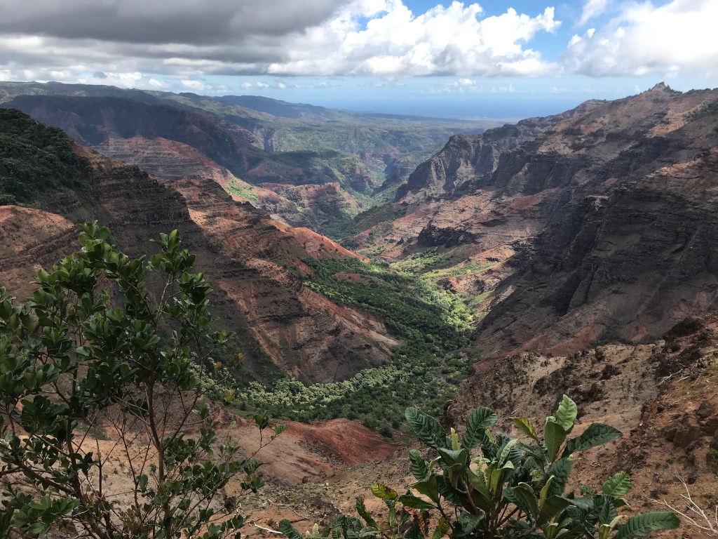
Waimea State Park includes the Waimea Canyon which is sometimes referred to as the “Grand Canyon of the Pacific.” Although this quote is often attributed to Mark Twain, others say the moniker became popularized by John Wesley Powell, an American explorer, who visited Kauai in 1869.
I don’t know who dubbed Waimea the Grand Canyon of the Pacific, but the name is certainly apropos.
Waimea Canyon State Park encompasses 1866 acres of land and the canyon itself is 1 mile wide, 10 miles long and is 3000-3500 feet deep. I have seen a list of over 25 hiking trails within Waimea State Park and the adjacent Kokee State Park, so we had quite a selection for our two days.
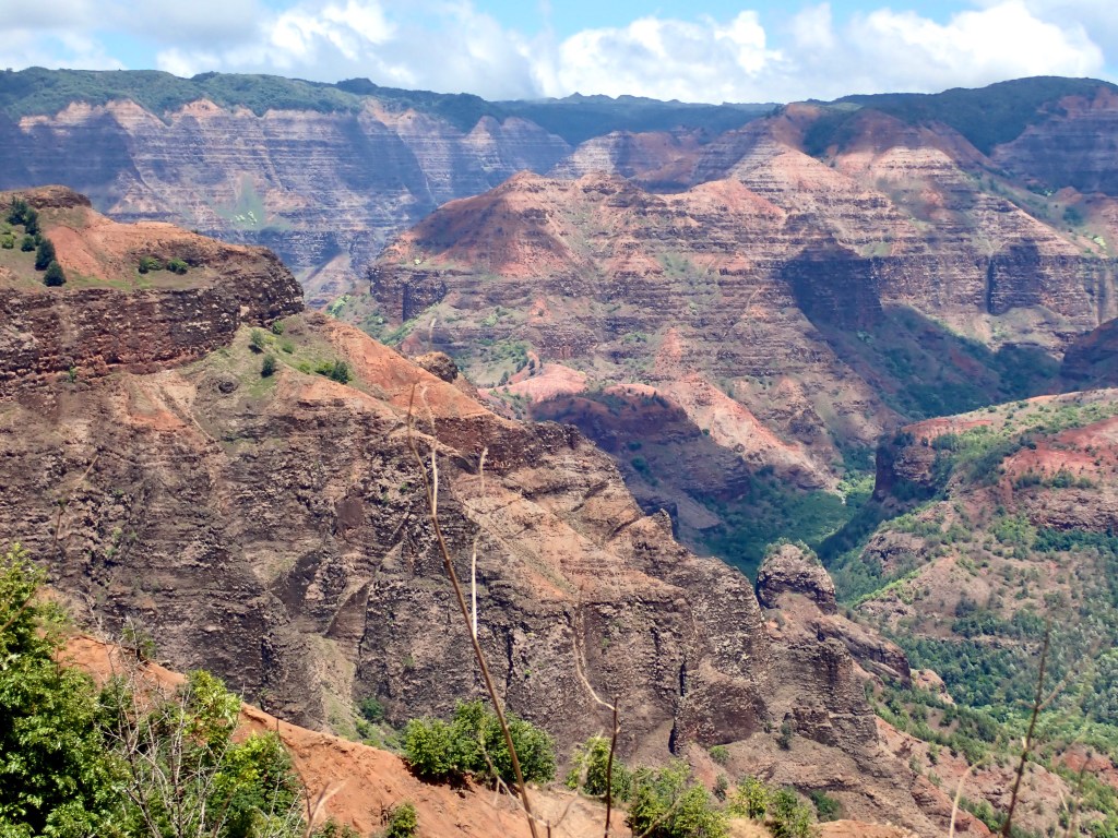
For our first hike, we chose the Kukui Trail, a trail that traverses the side of the canyon and descends about 2000 feet. The drive time to the Canyon caused us to begin a bit late in the morning on this trail that is listed as “difficult.”

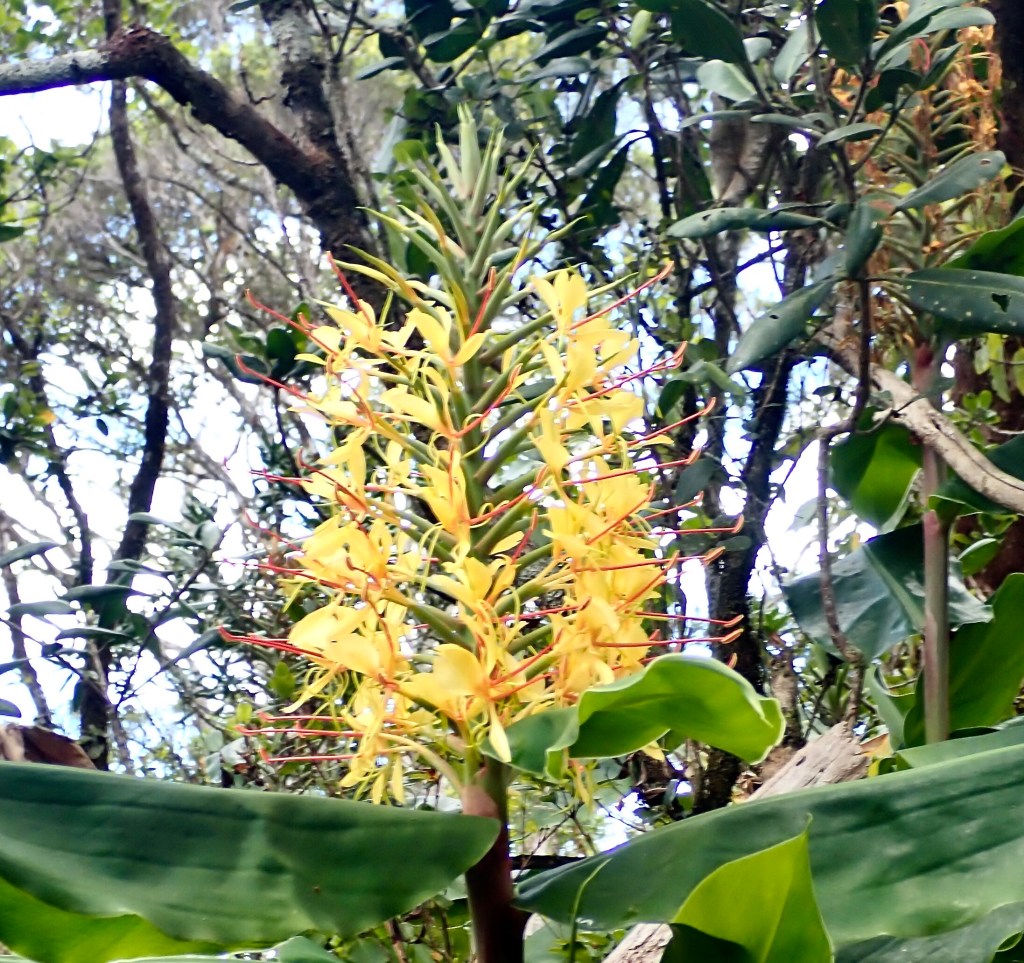
I wasn’t feeling great that day so we only walked about 1.5 miles, then turned and hiked back up to the top of the trail. The Canyon trail felt completely different from our hike on the Kalalau Trail. The Canyon was much warmer and instead of lush greenery and water, the Waimea Canyon looks like parts of the southwest areas of the Mainland.
Although we only walked 1.5 miles out instead of the whole 5 miles round trip, we saw a good sampling of this trail and had some excellent views.
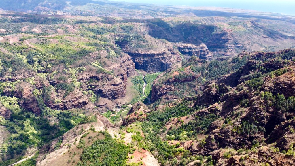
Once we reached the top of the trail again, Frank flew his drone and captured a few pictures from above so we could see what we had missed by not walking all the way to the bottom of the canyon.
As you drive up state road 550 to Waimea and Kokee State Parks, there are three official lookouts and a few others. These stops offer pretty views for those who don’t want to actually hike. Since I had called off our hike early, we drove the remainder of SH550 and stopped several times to look around.
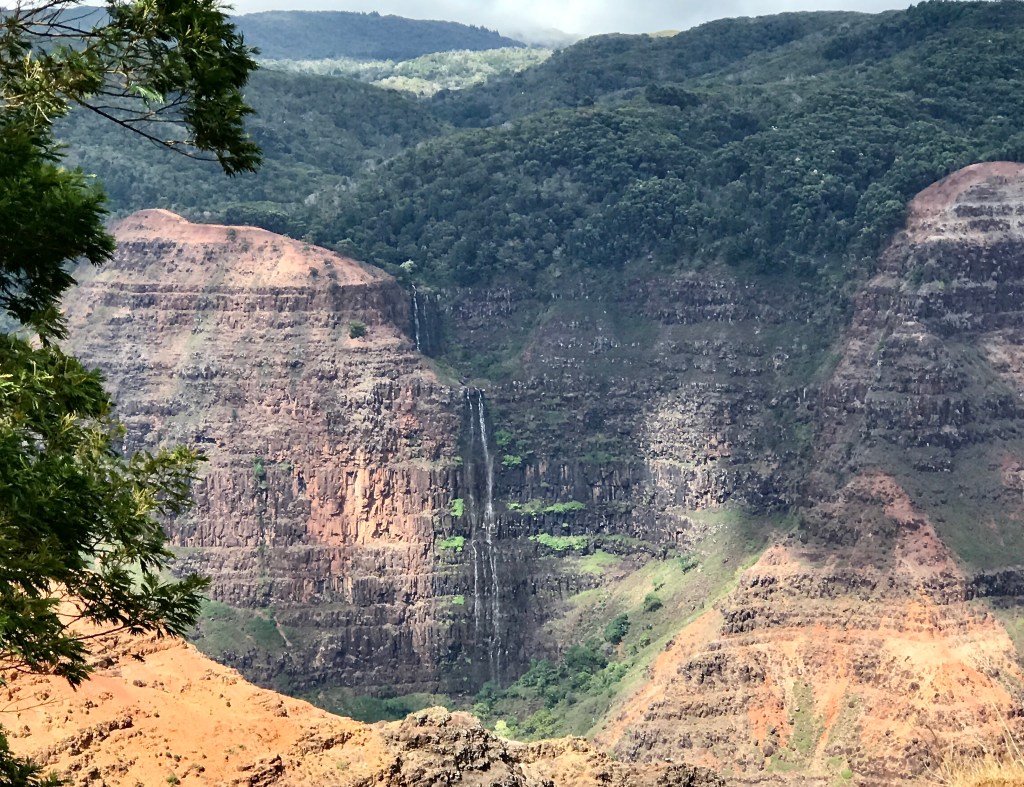
Once again we found ourselves in a unique situation due to COVID 19. We stopped at three overlook parking areas that had elevated viewing platforms and public restrooms. We only saw one car at all of these stops! It was surreal and felt almost apocalyptic though it was also serendipitous to have these views to ourselves because the lack of noise added to the serenity.
Waimea means “red waters” in Hawaiian and is the name given to the River at the bottom of the canyon because the water has a red hue caused by the breakdown of the red soil through which the water passes.

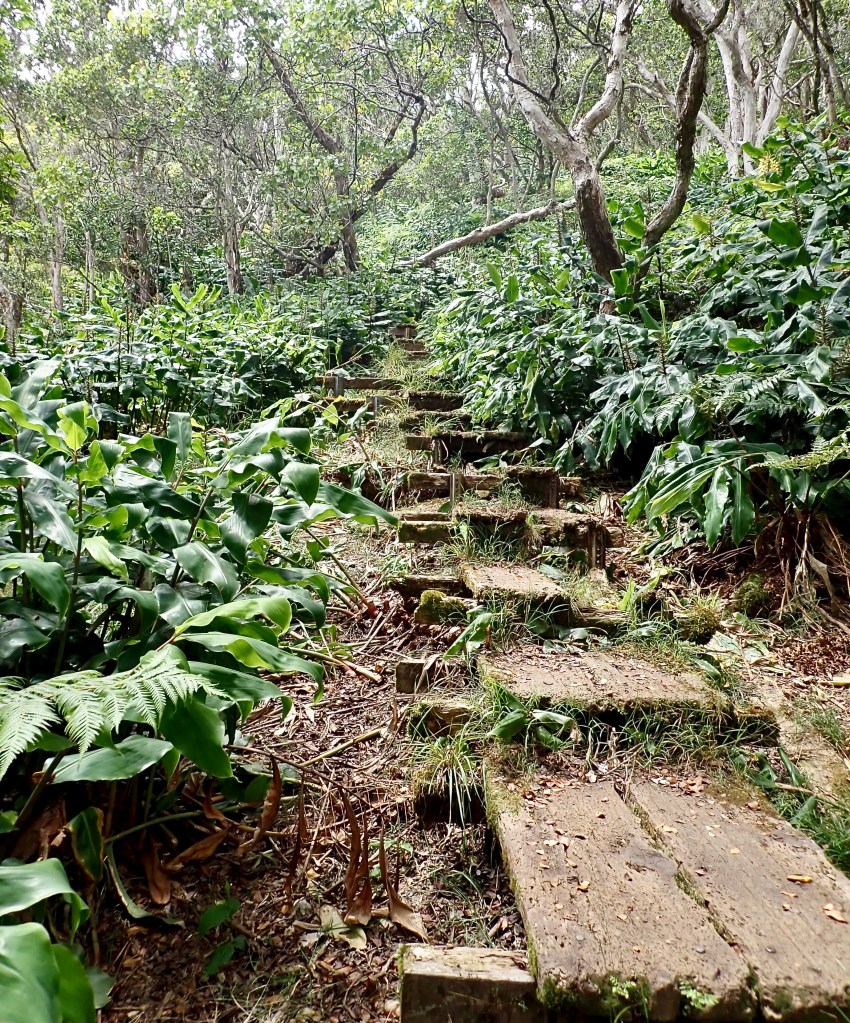
After spending an excellent evening with Katie and Kevin, we headed back toward the Canyon. This time we sought a different type of trail and chose the Alakai Swamp Trail in Kokee State Park. The Alakai Swamp trail is 7 miles round trip and, although listed as difficult, we didn’t think it was terribly hard. There are parts of the trail that require you to climb up/down a sort of sandstone type of rock hill but there are reasonable footholds and the trail is well delineated.

Luckily I felt well again and we had a great time on this hike. The terrain changed often and we walked on sloping rock, soft ground, raised walkways, dilapidated wood steps, across a stream and up and down sandstone rock hills!


The Alakai Swamp is fed by water from Mount Waialeale. Mount Waialeale is one of the wettest places on earth and averages 450 inches of rainfall per year. The rainwater drains off of Mount Waialeale into a plateau where the water collects and forms the Alakai Swamp. I read that the Alakai Swamp is the world’s highest rainforest and swampland, though I have been unable to verify that statement.
The “swamp” was nothing like the swamps of Frank’s childhood in Louisiana! We didn’t see one alligator and we certainly couldn’t take a pirogue through it as there was comparatively little moisture in the mud and no river anywhere. Of course we knew this would not be the same kind of swamp.

Prior to 1991 when Hawaii began the installation of a raised boardwalk, hikers sloshed through the muddy swamp to get to the Kilohana Lookout at the end of this trail. Realizing the negative impact of so much traffic on the plants and shrubs, the State added the boardwalk and significantly reduced the impact of hikers. The boardwalk is raised and 12 inches wide while the previous walking trail had become as wide as 30 feet in places.
According to the University of Hawaii, Alakai means “one-file trail” and adding the boardwalk makes it a single file track again.

The Alakai Swamp Trail ends at an overlook where Hanalei Bay can be seen on a clear day. We were hoping to see Ticket to Ride floating in the bay from that vantage point but the clouds rolled in and a light mist began just before we reached the furthest point. We didn’t have enough visibility to see the Bay.
So we turned around and began the walk back toward the parking area. About half a mile into our return, we were far enough from the coast that the sky cleared and the mist disappeared.

Of the two hikes, I preferred the Alakai Swamp Trail. I think there is greater variety on the Swamp Trail from what you walk on to what you see. I liked the variety of foliage, the movement from clear areas to shaded ones and the undulating trail. I think the Alakai was easier than the Kukui Trail where we were always walking down on the way out and always trekking up on the way back. Others will surely prefer the vastness and grandeur of the Kukui Trail.

Thank you for stopping to read our blog. I hope seeing these pictures of Kauai brings you joy and reminds you of the goodness and beauty of our world. If you want to hear from us more often, please see our Facebook page or follow us on Instagram. Stay well and be kind.

This Eric crew of Alex and Baraba Cross really enjoy the Latitude article keep having fun
Eric
LikeLiked by 1 person
Hi Eric. Thank you so much for the feedback on the Latitude 38 article! Be sure to tell Alex and Barbara hello for me!!! I hope you amd they are staying well.
LikeLike