
Currently Ticket to Ride is anchored in Kaneohe Bay on the island of Oahu, HI.
Choosing to anchor where we did was random, but we have found that sometimes random anchor spots allow us to stumble upon something. Similar to an unexpected find on Martinique way back when, we love it when we happen upon an interesting place that we probably would not have heard about in a guide book. It is sort of like cruising lagniappe! (Lagniappe: something given as a bonus or extra gift.)
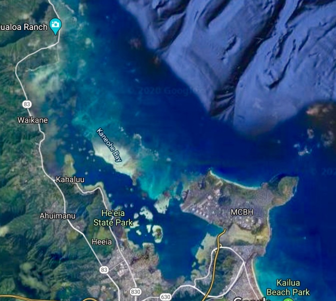
Photo credit: Google Maps satellite images
Located on the windward (east) side of Oahu, Kaneohe is the largest estuary in Hawaii and covers about 11,000 acres. Although the opening of Kaneohe is more than 4.5 miles wide, outside of the bay lies the only barrier reef in Hawaii which breaks the ocean swell and provides protection in the bay. Even when the trade winds are blowing outside the bay, the anchorages are very calm, especially in the southern part of the bay. This is particularly nice for us on TTR because the breeze keeps us cool but the boat has very little motion at anchor.
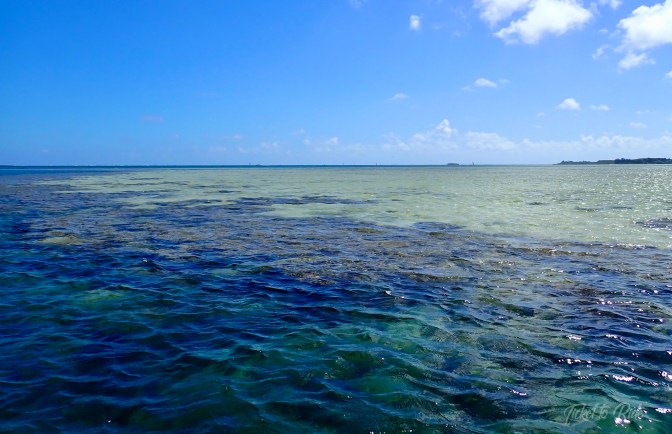
It’s interesting to SUP along the coral that rings the sandy areas.
Meandering through the long channel to get to our anchor spot, we passed several shallow areas of sand and coral. These shallow areas are often right next to the channel and the depth on the reef is ankle deep at low tide, but where the outer coral ring ends the depth immediately drops to 30+ feet.

“The Sandbar” is very popular for family gatherings, kiting and fishing.
Boaters often motor right up onto this sandbar then lay a stern anchor. Unwilling to nose TTR onto the sandbar, we chose to drop anchor a bit off of the bar and SUP to get to the shallows. We were only able to stay at this spot for a night or two.
I read that the Kaneohe area was the most heavily populated part of Oahu during the “pre-contact” era of Hawaii. (Research indicates that pre-contact is considered to be prior to the arrival of Captain James Cook sometime around 1778.)
The fact that Kaneohe is an estuary, which means that one or more fresh water streams or rivers mix into the seawater, is important and was influential in the lives of these Hawaiians.
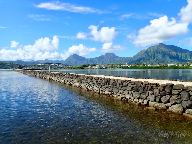
The mixing of fresh water and seawater creates a brackish water that is perfect for growing algae that nurtures fish. As many as 600 – 800 years ago, native Hawaiians recognized that value of this brackish water and put it to use for loko iʻa kuapā; walled coastal ponds. Below is a picture of the He’eia Fishpond that encloses 88 acres of brackish water.

Photo credit School of Ocean and Earth Science Technology, HI
The He’eia Fishpond wall is about 1.3 miles long and has seven gates; four along the seaward wall and three along the He’eia stream, which allows for controlled mixing of the salt and fresh water to create this brackish enclosure.

One of the seaward gates.
Trapping fish in this brackish enclosure allowed Hawaiians to supplement their food source in an area that naturally developed food for the fish and eliminated the need for a caregiver to feed the fish.
“Ocean fishing is dependent, to a great extent, upon conditions of the ocean and weather. High surf, storms, and other associated weather phenomenon influence and interrupt most fishing practices. Therefore, fishponds provided Hawaiians with a regular supply of fish when ocean fishing was not possible or did not yield sufficient supply (Kelly, 1976),” per the Paepae o Heeia website.
It is amazing to me that hundreds of years ago, these Hawaiians had a back up plan for days when traditional fishing methods did not provide enough food for their people.
A portion of the He’eia Fishpond wall.
As you can see in the picture above, this pond is not built with one wall but two. Each wall is constructed of basalt (volcanic) rock and they are 12 to 15 feet apart. The section between the two walls is filled mostly with coral but also with dirt. The purpose of the two walls is to slow the flow of water and create a base level of water in the pond so that even at low tide there is sufficient water for the fish.

Looking over the wall toward shore where early Hawaiians probably lived.
It is estimated that building this loko iʻa kuapā took two or three years of dedicated work by hundreds or even thousands of residents who passed and stacked rock and coral.

Another example of the seaward gates.
In May 1965 a flood ruined a 200 foot section of the He’eia Fishpond and it went unused until 1988 when Mark Brooks began repairing the wall. In 2001, Paepae o Heeia, a non-profit organization, was established with the express purpose of restoring and caring for the He’eia Fishpond.
Today this historic and innovative walled pond is fully restored and in excellent condition. TTR is anchored about 300 yards from the Fishpond and on calm days we can paddle along the wall and see the waters entering or leaving the gates depending on the tide.

Shallow sand and coral just off the Fishpond wall.
Kaneohe Bay is so large that there are many areas to explore, but until our two week, inter island quarantine is finished, we have to remain anchored here, so we haven’t had a chance to see as much as we would like.
But the Q will end soon and we have no complaints about our location. The views are stunning, the temperatures are very comfortable and in addition to learning about He’eia Fishpond, we are taking care of routine maintenance on TTR.
As always, thank you for stopping by to read our blog. I posted a video of the He’eia Fishpond on our FB page, so be sure to head over there if you want to see the video or hear from us more often.


Wow. Thank you for this very interesting read, I had no idea about this place. Photos are great as usual.
Love from Temerity
LikeLike
Thanks dear! Glad you enjoyed it. Also glad y’all arrived safely on the East Coast. Hugs.
LikeLike